
Satellite maps and small towns
I've been fascinated by the occasional reporting from England about how residents in at least one small town have been disturbed by cross-country lorry traffic passing through, at least since satellite navigation systems and online mapping services have shown shortcut routes on small roads and lanes only meant for local traffic. Via Greenslade, The Mail on Sunday had a story about three railroad bridges that have been hit 62 times in the last year. The Mail calls it 'the curse of Satnav'.
How much traffic is sent in bad directions by satnavs and Mapquest and other mapping services? I've directed visitors to our remote house via the best main roads with least curvy sections, but some have relied on online maps and been directed to the 'shortest' but most disorienting and difficult routes, adding hours to the trip at times.
I've recently gotten access to Google Earth and found roads near us badly mislabled. The online maps like Google maps, Mapquest, Yahoo maps and the like are pretty reliable but still don't know the local road conditions.
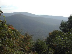
The state highway near us sees lots of cross-country cargo trucks, which I expect are going through because it looks like a shortcut to Knoxville from north Georgia. Well, it must take those big trucks a long time, with all the tight curves they need to slow down for. Even worse, U.S. 129 through the Smoky Mountains between NC and TN is a road that motorcyclists -- who love it -- call 'Tail of the Dragon' for its dozens of curves. But there are always trucks, sometimes getting stuck on a curve too short for its length. It looks good on a map.
How much traffic is sent in bad directions by satnavs and Mapquest and other mapping services? I've directed visitors to our remote house via the best main roads with least curvy sections, but some have relied on online maps and been directed to the 'shortest' but most disorienting and difficult routes, adding hours to the trip at times.
I've recently gotten access to Google Earth and found roads near us badly mislabled. The online maps like Google maps, Mapquest, Yahoo maps and the like are pretty reliable but still don't know the local road conditions.
The state highway near us sees lots of cross-country cargo trucks, which I expect are going through because it looks like a shortcut to Knoxville from north Georgia. Well, it must take those big trucks a long time, with all the tight curves they need to slow down for. Even worse, U.S. 129 through the Smoky Mountains between NC and TN is a road that motorcyclists -- who love it -- call 'Tail of the Dragon' for its dozens of curves. But there are always trucks, sometimes getting stuck on a curve too short for its length. It looks good on a map.
posted by liz at
10:24 AM
![]()


1 Comments:
Liz,
I suspect that some of those large trucks on back roads across state lines are avoiding weighing their loads. Coming from TN via our road thru Murphy gets you into NC without the scales and only an occasional highway patrol.
By Anonymous, at 7:39 PM
Post a Comment
<< Home